I wrote about the wreck of the SS Marion at Marion Bay & the wreck of the SS Willyama.
The SS Marion ran ashore about 1½ miles
east of Cape Spencer in July 1862. She is said to have been wrecked in the bay
already named Marion Bay after an earlier shipwreck. The 919-ton, three-masted,
wooden (teak) migrant ship Marion was wrecked on a reef near the Troubridge
Shoal, almost 11 years earlier, in July 1851. Both Marion Reef and Marion Bay
were named after this earlier shipwreck when some of the survivors (360+
passengers & crew?) from it landed at Marion Bay. Another group of
survivors landed at Cape Jervis. A one-masted wooden cutter called Marion was
broken up at Louth in South Australia around 1912.)
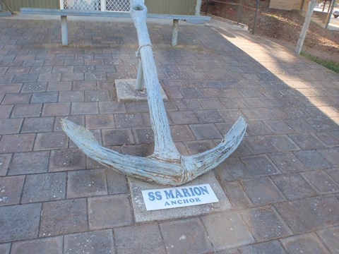
An anchor from the SS Marion located at the Marion
Bay Historical Centre
(Photo: Steve Reynolds)
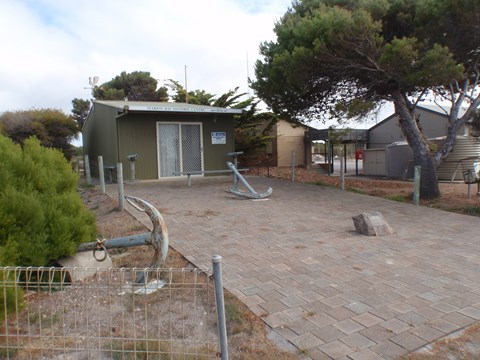
Marion Bay Historical Centre with anchors from the
Willyama (left) & the Marion (rear)
(Photo: Steve Reynolds)
According to Yorkes Live’s web page
“Shipwrecks On Yorke Peninsula”, “The wreck of the S.S. Marion lies
at the base of a cliff, in 2-7 metres of water, east of Chinamans Hat Island,
and to the south-east of the car park at Cable Hut Bay.” This either originated
from the “Investigator Strait Maritime Heritage Trail” booklet published by the
State Heritage Branch of the Department of Environment and Natural Resources in
1996, or is repeated in that booklet.
The location of the wreck (in both cases) is given as being:
Latitude 35° 17' 17.1" South, Longitude 136° 55'
18.4" East
The booklet includes a map of the location for the wreck and
a map of the wreck site.
According to the booklet (as at 1996), “Little of the hull
structure remains to be seen because the wreck, which is scattered on a
northerly axis for a distance of some 60 metres, is located on a predominantly
rocky bottom in a high energy zone. The wreckage is divided into two distinct
locations with the forward part of the ship broken and scattered over a shallow
reef shelf, and the tern lying in an area of patchy sand in deeper water at the
base of the reef.
“Amongst the wreckage of the stern the rudder is clearly
visible lying at a depth of 7 metres, with the Propeller shaft about 8 metres
further inshore. Remains of machinery, possibly the engine, can be seen
Nearby. Seaweed and
rocky crevices obscure the scattered remains of the bow, but frames, beams and
the remnants of other structures can be identified. Fragile artefacts, part of
cargo and fittings, can be lodged in crevices in the rock platform.”

No comments:
Post a Comment